Tank Lakes, Adieu - July 2025

My birthday weekend meant we ought to do something memorable, and our third and my last visit to Tank Lakes fit the bill. The trip was a mix of type 2 and type 1 fun, probably more type 2, honestly, but the views always justify the effort to reach Tank. Tank Lakes’ popularity has soared with social media due to the jagged peak and lake/tarn drama. Also, the Alpine Lakes High Route, which the hike to Tank includes, is increasingly landing on bucket list hikes in Washington, just like the Enchantments thru-hike has become…
Tank Lakes is the stretch goal beyond the Necklace Valley hike up to the top of the East Fork Foss River in the core of the Alpine Lakes Wilderness. It’s also a common route for approaching the summit of Mt. Hinman, a broad mass of a peak next to King County’s highest point, Mt. Daniel.
But we weren’t heading that far. Just to Tank. Just.
Prior visits in 2015 and 2017, we split the trip up into an overnight; I think both times we got a Friday afternoon start, so there wasn’t time to get to Tank in daylight. Then we got up the next morning and finished the slog to reach Tank, where we’d soak up the views, wade in the lakes, and relax before heading back down after a night or so.
This time, I/we (not really sure) decided to do the hike up in a single day. Okay, that’s a stretch goal, but we’d recently done a few other trips that were moderate to hard, including that very long day up to almost Red Pass along the PCT and then back out, which wiped me out. I’m not in the best shape, but I usually gain ground pretty quickly as I start backpacking. Nothing like spending five or six hours in exercise zones 3 and 4 to build back that cardio.
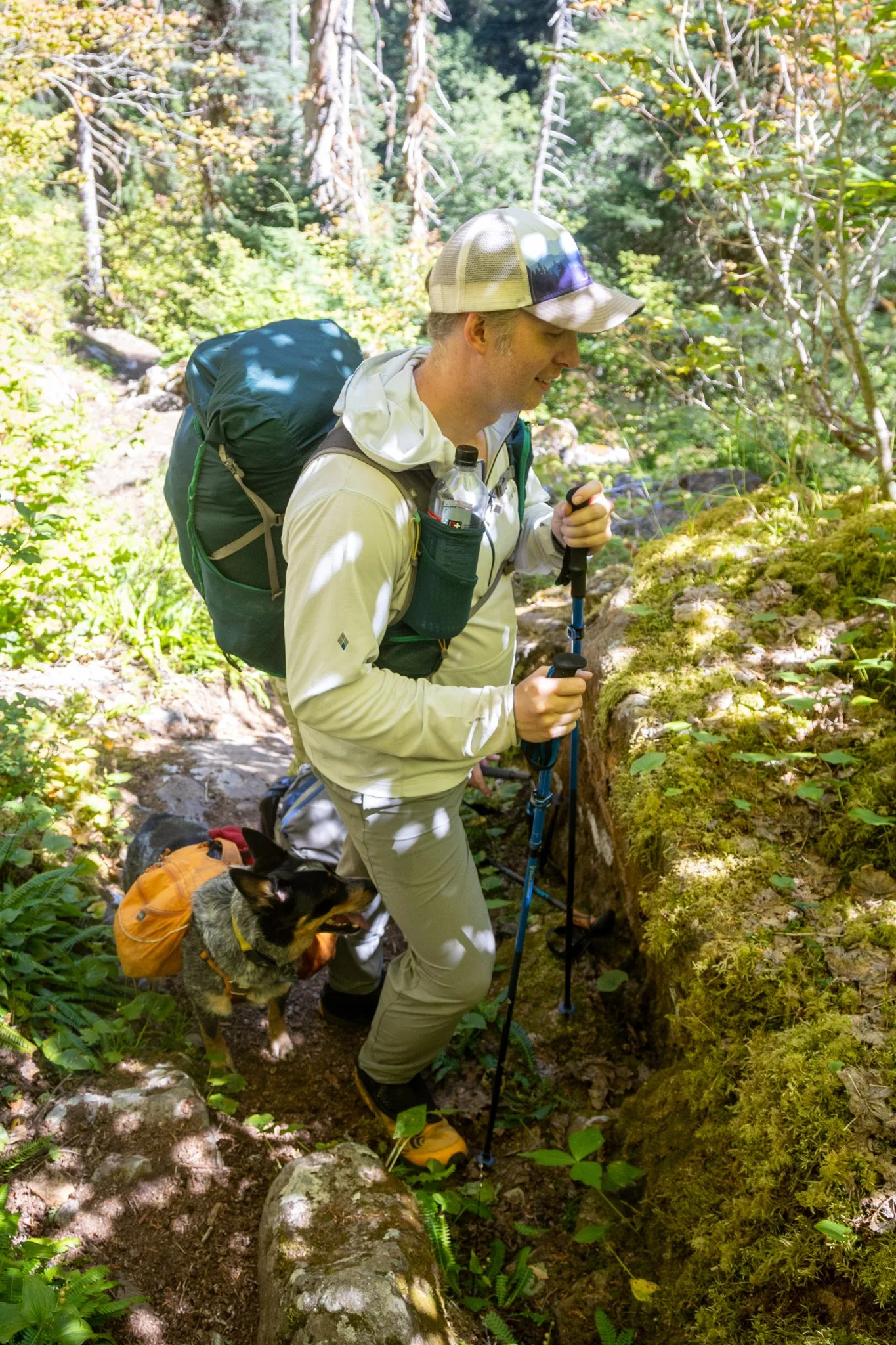
Paul was on our 2017 trip with us where we hiked up about seven miles to a tiny riverside camp the first night. I do remember waking up and heading up, and immediately hitting some of the gnarliest parts of the trail on the steep. The trail is rugged; every step you’re on either rocks or roots, often both, and no two steps are the same. You never get to choose how far or high you step, because there’s only a few places to put your feet, so you’re using all of your leg muscles, the stabilizers, and giving all your tendons and ligaments a really good workout.
Let’s have a talk about difficulty. It really is relative to whatever physical state you’re in. If you’re a mountaineer peak-bagger, you use hikes like Tank just to get to the base of your climb, and then the real effort starts. But honestly, the approach climb is when you’re taking all your gear, including your overnight kit if you’re not doing a one day car-to-car summit and out. Mountaineers are typically very lean, very fit, and have cardio levels that rival top athletes that enable them to easily (but not effortlessly) reach their climb, and then have plenty in reserves to rest and then attack the summit the next day, and then usually, hike out.
But that’s not me; never been me. I’ve been in better shape than I am now, and yeah, I did this hike ten years ago when I was putting more miles in and weighed less. Regardless, I had some modest confidence that regardless of how hard Tank was, I’d get myself back up there, and I’d do it in a single day. We had all day and the three of us would support each other. Plus, it’s my birthday, so I’m allowed some latitude. I have tackled some hard hikes over the years, but again, what’s hard for me might be pretty moderate for many other folks. For people who’ve never hiked or backpacked before, I think Tank would be very formidable, especially if you’ve never been in The Cascades.
So Paul was in the area visiting family with Lynn and their toddler Lydia and had a few days’ break to join us. We hemmed and hawed about routes; our first choice, a return to Spider Gap and beyond, was thwarted by the Pomas fire in the next canyon east. We looked at other ideas in the same area, but maybe it was Paul who suggested revisiting Tank. I mean, normally we don’t do hikes three times (or me & Beck), but it has become an iconic spot to spend a special weekend.
We met at the trailhead a bit after 9AM Friday and headed up the glorious green gauntlet along the old mining road-turned-trail that starts up the East Fork Foss River toward the Necklace Valley. All easy and barely breaking a sweat in the low 60F’s.


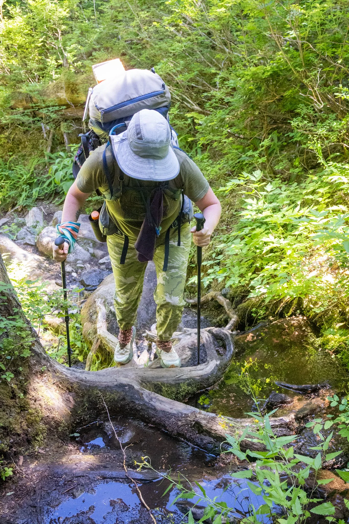
The entire hike to Tank is about 11 miles give or take, depending on how well you remember some odd twists and turns after you clear the Necklace Lakes, and which set of cairns you choose to guide you up the final mile or so. It also gains 4,200ft, with 3,600 of that over the last six miles. Again, I’ve done many hikes with similar or even more aggressive stats, but the Necklace Valley trail is a real mess once you cross the river and start heading up. It really is two different trails, and it’s clear that the upper parts get very little maintenance.

After we cruised along the five miles, we grabbed lunch before starting on the real work heading up. We crossed over the creek on the old log which ends in a big pile of rocks, then you have to weave over and through to get on the main trail grade, traversing upward along the west side of the river valley through a mix of older-growth and brushy avalanche chutes. There’s a stretch of brushy stuff that is really annoying; it heads up a few hundred yards, in full sun, amidst the brush, with all the heat and humidity added on; quite a contrast from the shades coolness of the tall conifer forest.


At this point, I was really starting to wear down. Recent trips have taught me that I need to pay better attention to my liquid, electrolyte, and calorie intake, meaning more of everything, but even with that, my heart was beating out of my chest and lungs were stressed. So every few hundred yards I’d ask Paul to hold up to take a break. Both he and Beck were very gracious to accommodate my breaks, and couldn’t help but think back years ago to when the tables were turned and I was the impatient lead hiker always out in front, stopping to let others catch up to me, only to race ahead again when they go to my break point. So I really appreciated their patience.
Somewhere around mile seven we hit the campsite we overnighted at in 2017 and had a good rest and lunch. But then that rough section started, and it never really lets up until you reach Jade Lake at 8 miles.

Jade is the first jewel in the Necklace, and it’s a very welcome sight after the grind. We hiked along the shore and rested again in the big campground near the inlet. Bugs weren’t too bad. Yet. Back on the trail, in a few minutes we were at the Necklace Valley shelter and the one and only toilet up here. The mosquitos clearly have evolved to know to hang out near toilets because they hit you on all fronts and backsides when you’re at their mercy while attending to your business.
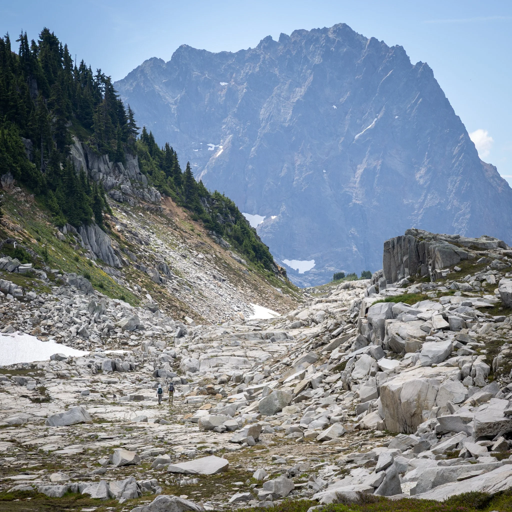
The next part of this hike is pretty fun, actually. It winds through meadows and piles of rocks and clumps of trees, not gaining too much, and eventually you’ll walk a short way on a nice granite-gravel path that you’d expect at the local botanical garden and then boom! You hit the rocks. The good news is you know exactly what’s left; about a mile and a quarter and a thousand feet to gain Tank Lakes. The bad news is it’s all rock, loose scree, and every step is trying to break your ankle or scrape your shin. Some stick ripped into my forearm and I had a nice blot of blood to show for it. Great opportunity for the skeeters to belly up to the ready-serve bar.
We took the bootpath. When you say bootpath, you generally mean you’re taking the steepest, most direct route, typically established by miners a century ago and also the route of choice by mountaineers who don’t want to waste time on anything less than a 25% grade. We’ve taken that route in the past, and it was fine, mostly, but there’s a few spots where your footing is iffy, and you will knock rocks down on your hiking partners. It is shorter, and it gets most of the elevation gain out of the way.
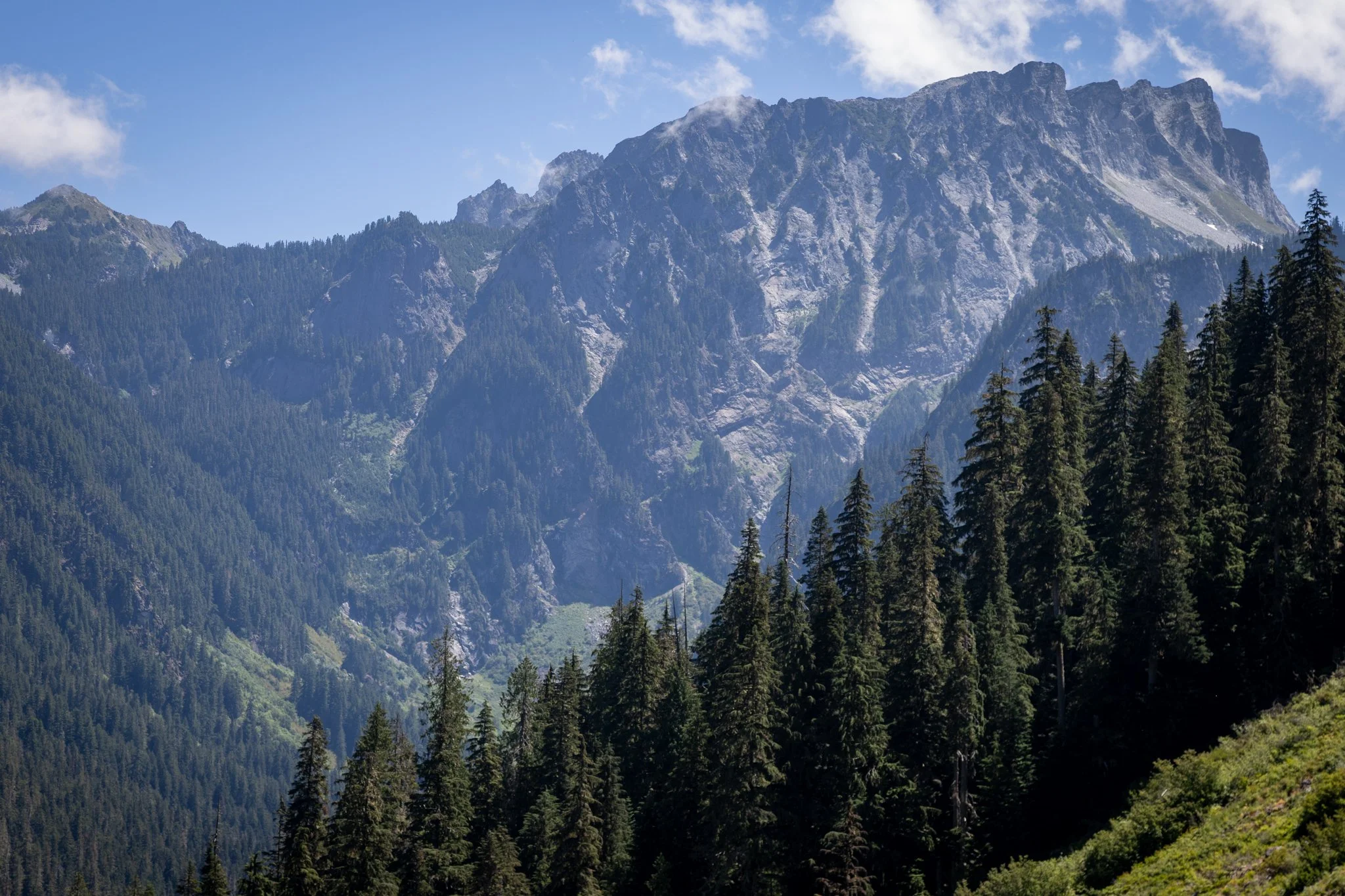
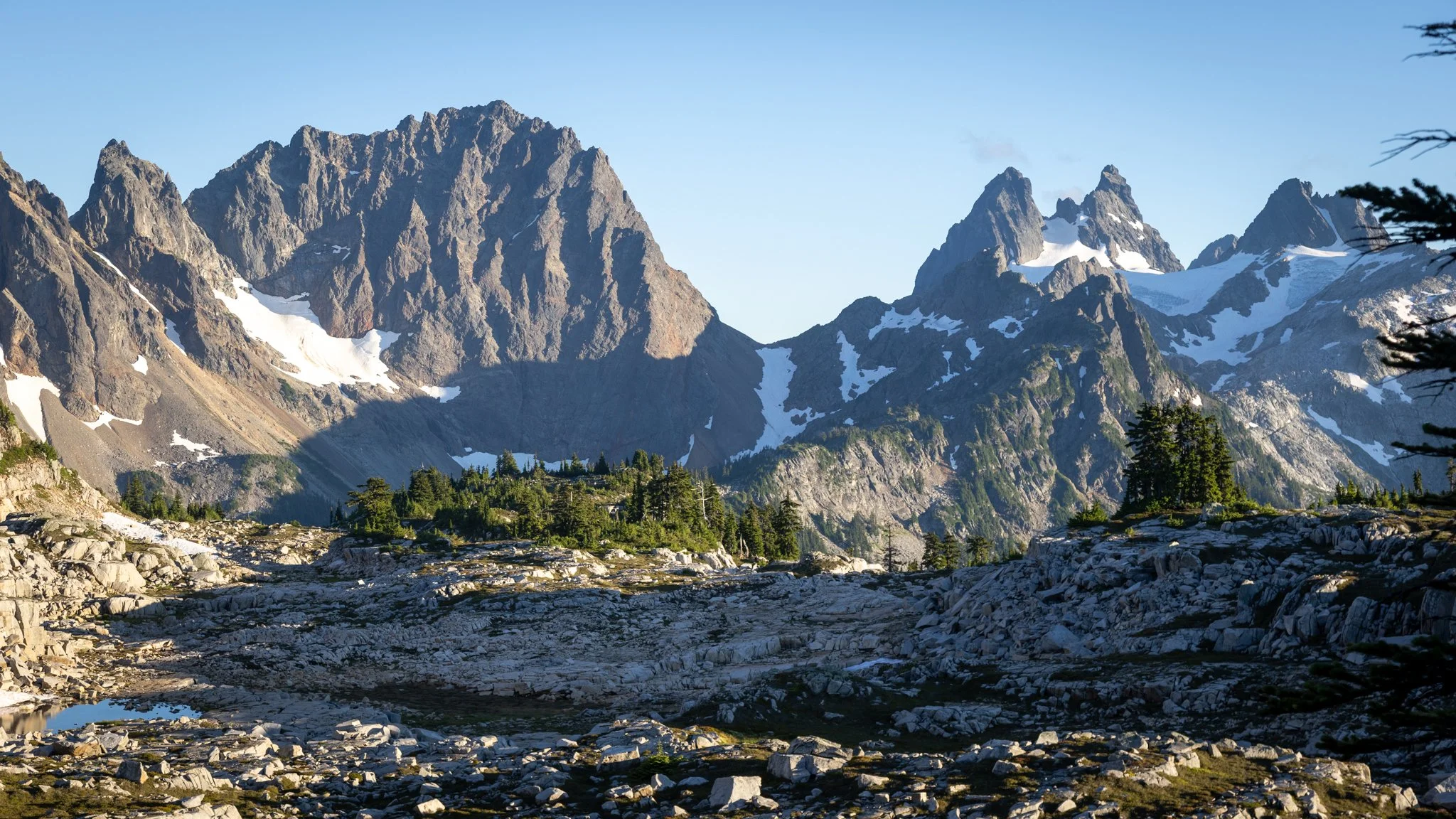
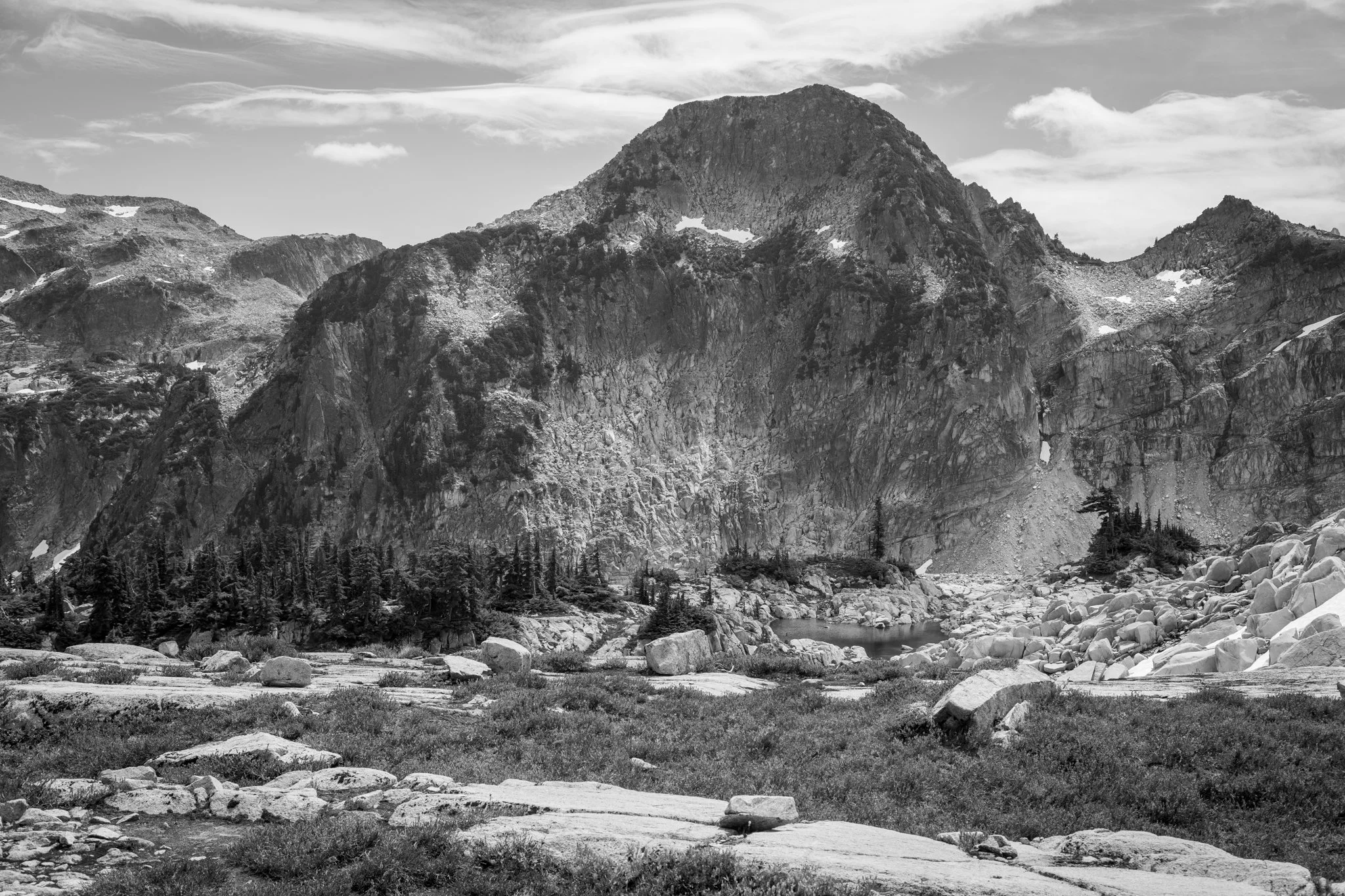
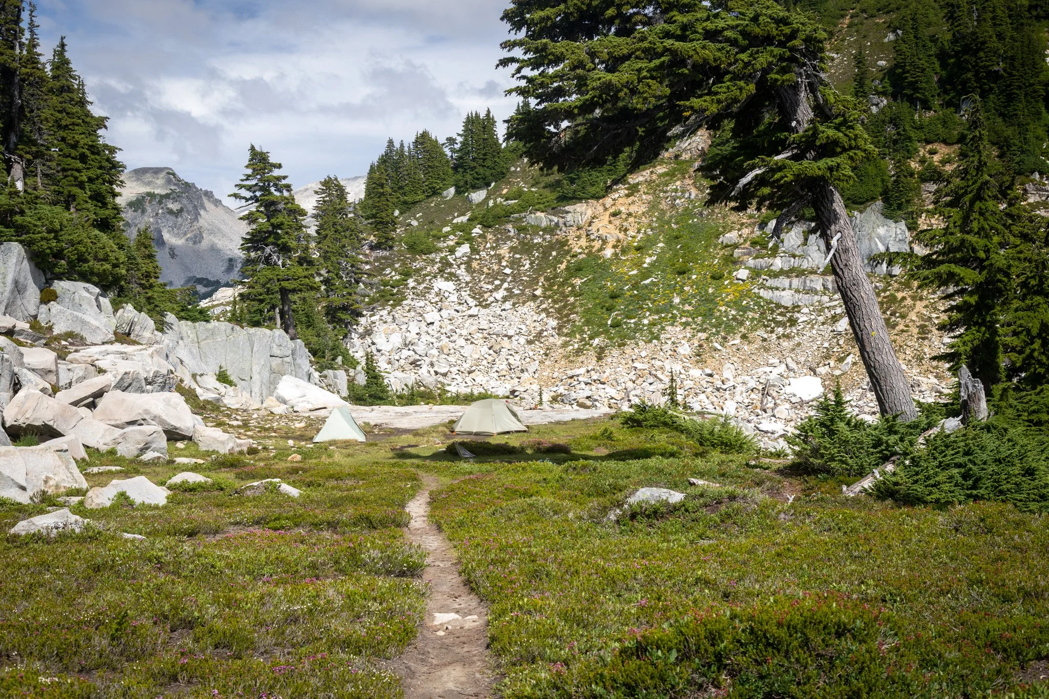
After a few strolls through seasonal tarns and snowfields, we turned the corner and reveled in the big reveal that makes it all worthwhile. Summit Chief’s three peaks, Overcoat, Chimney Rock all stand across the granite and tarns, just over two miles away, over the headwaters of the Middle Fork Snoqualmie River valley, connecting us back to North Bend. After a few moments, we surveyed and set our eyes to the right and returned to the excellent campsite we had a few years earlier.


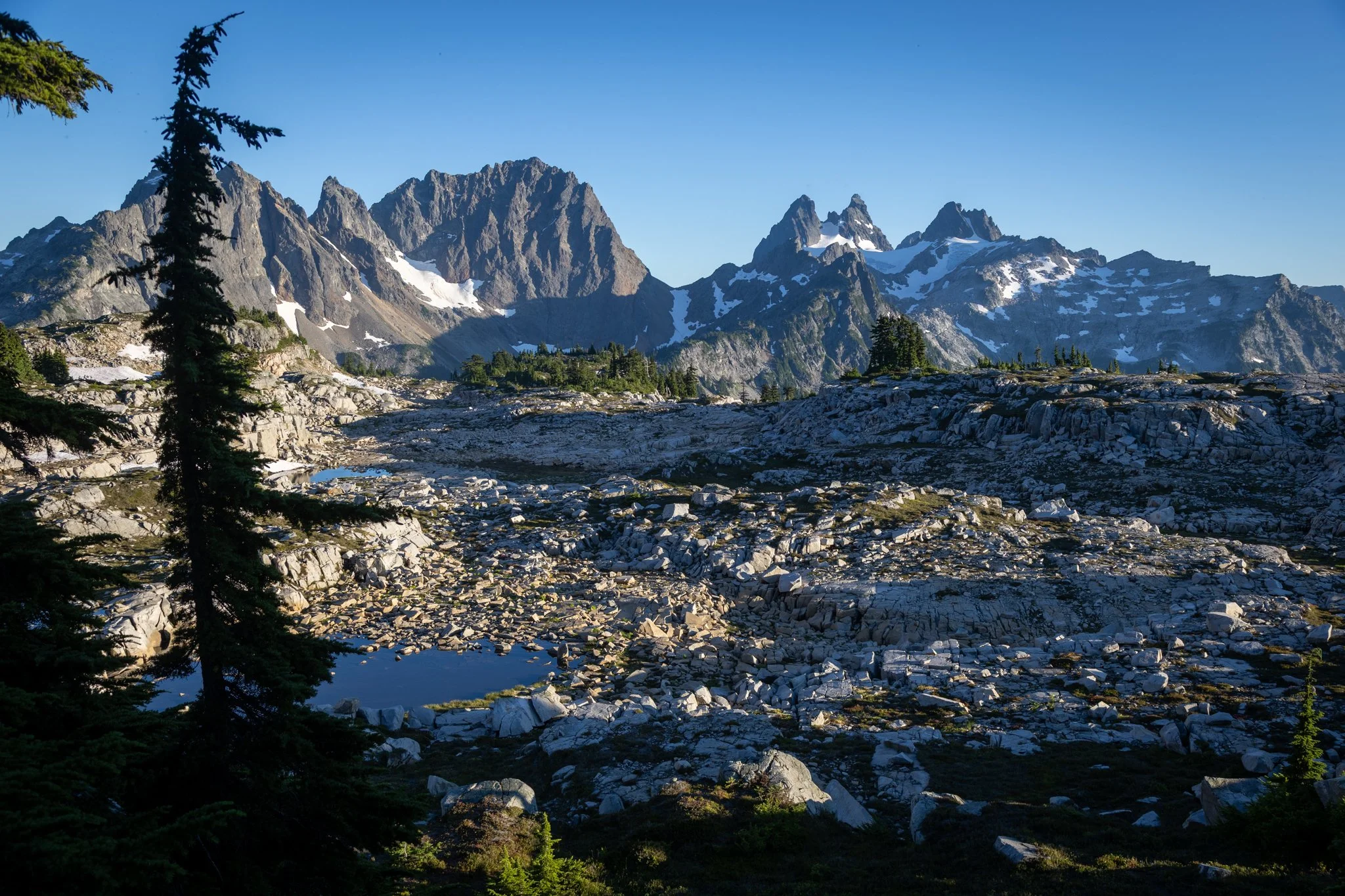
Only a few other folks were up there this early in the weekend. Again, in June, 2015, that low snow year/summer, we were the only campers up there. In 2017, there were probably 4-5 groups scattered around the granite and tarns. By the end of the day, a few others came in and settled in; some on the granite bench right below ours.
After camp was made, we had our dinners and watched as the angle of the sun’s light added drama to the jagged peaks over the valley. I moved about and snapped some shots, but the light and clouds were rather average and I already had many shots from earlier trips.
The bugs were moderate, in my eyes. I was Insect-Shielded in the new Columbia sun hoodie Beck gifted me for my birthday; I was somewhat skeptical of how effective the factory-infused permethrin was in the Insect Shield garment, but it did pretty well. This time of year, I usually treat my camp layer with permethrin regularly to ensure a fresh defensive barrier against the bugs. My pants and hoodie performed well and I didn’t even use my bug head net. I’m one of those people who bugs don’t bother much, and if I do get bit by a mosquito, it’s a short pin prick and done. No itches, no bumps.

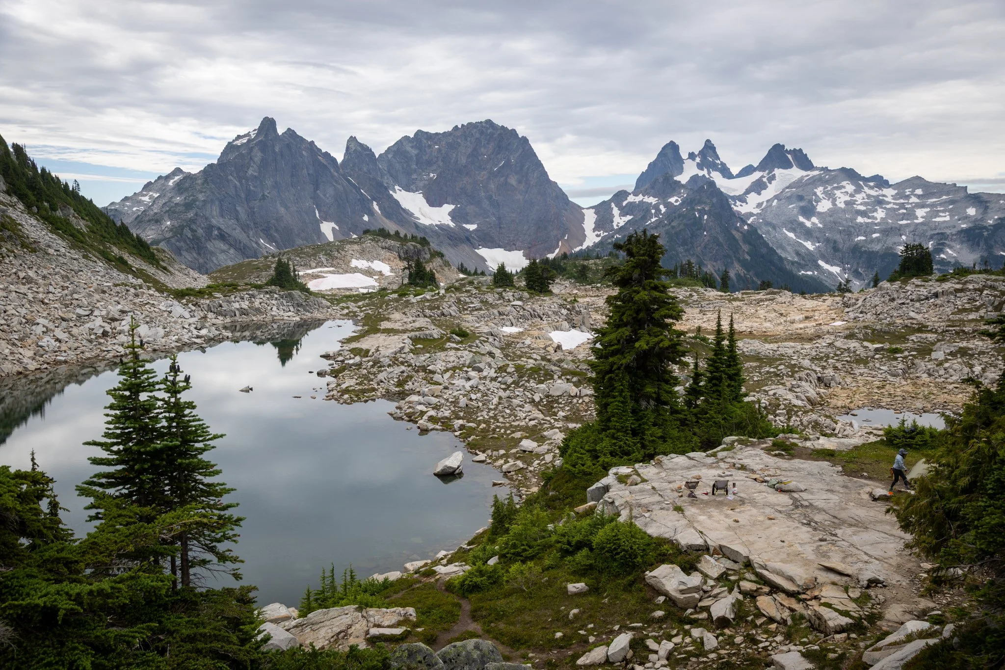
Campsite
We had a good sleep; our Govee thermometers recorded temperatures down to about 36F, but it really didn’t feel like that when we did our mid-night bio break. The air was still and rather humid.
We didn’t have huge aspirations other than to try to see what Otter Point was about. Previous trip reports say the views up there are epic, given it’s really in the middle of the two sides of the Foss River collection of alpine lakes, and it’s supposed to be a pretty easy scramble. We set off late morning and picked away north over layers and benches of grippy granite.


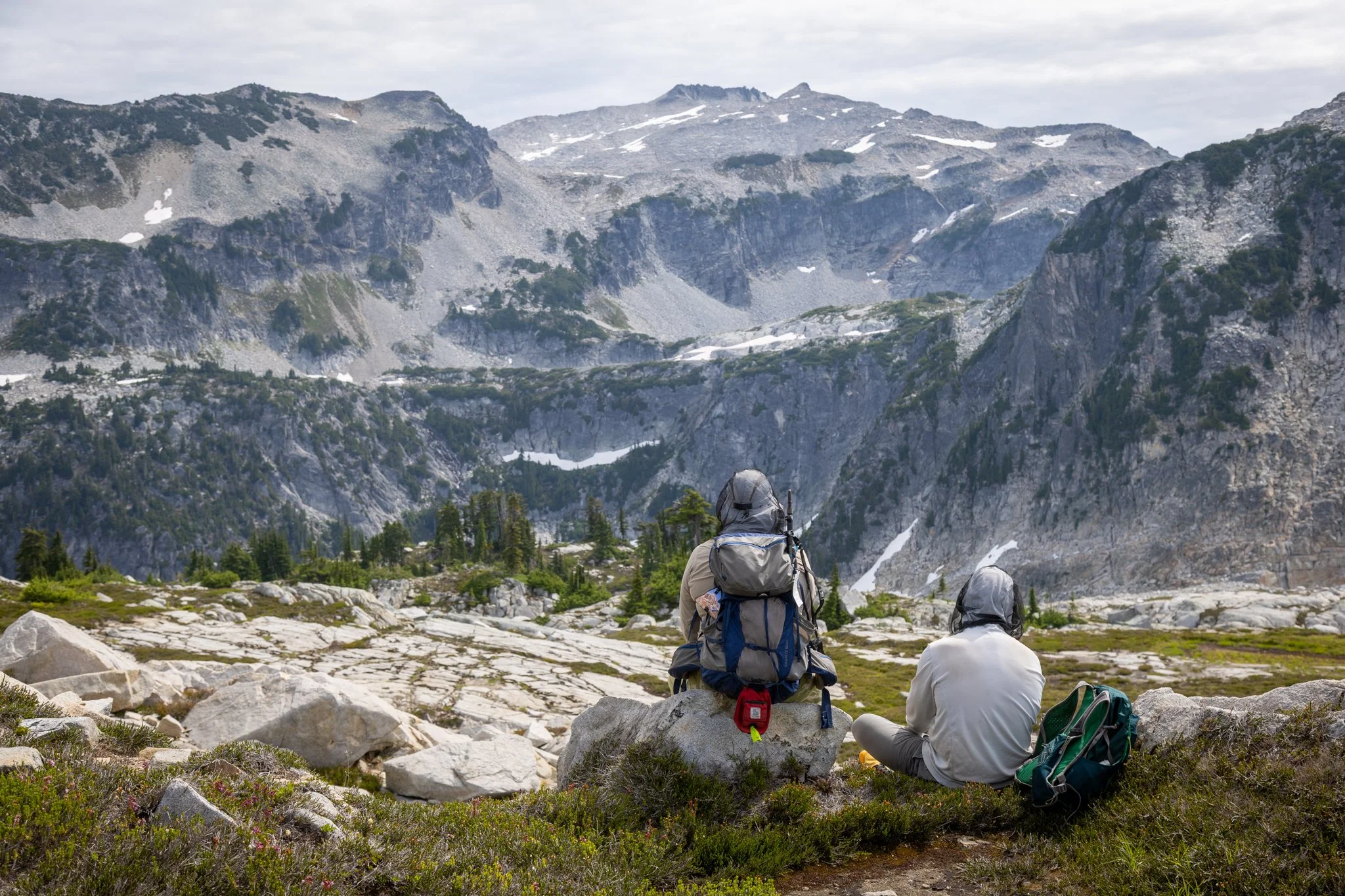
We made our way up the ridgeline a ways, but there wasn’t an obvious ‘easy’ route, especially considering Baker would have to figure it out, too. Normally I pay little attention to Baker navigating where I go, because he’s lower to the ground and has four paw drive. But once you start climbing up and over large, jagged boulders, it gets pretty tough for him. But honestly, we decided that the lack of a clear and obvious route and an excuse to take it easy for tomorrow’s exit, we gave up on Otter Point. We had some pretty grand views up there already. We considered going to Tahl Lake, but it was another third of a mile over more granite talus.


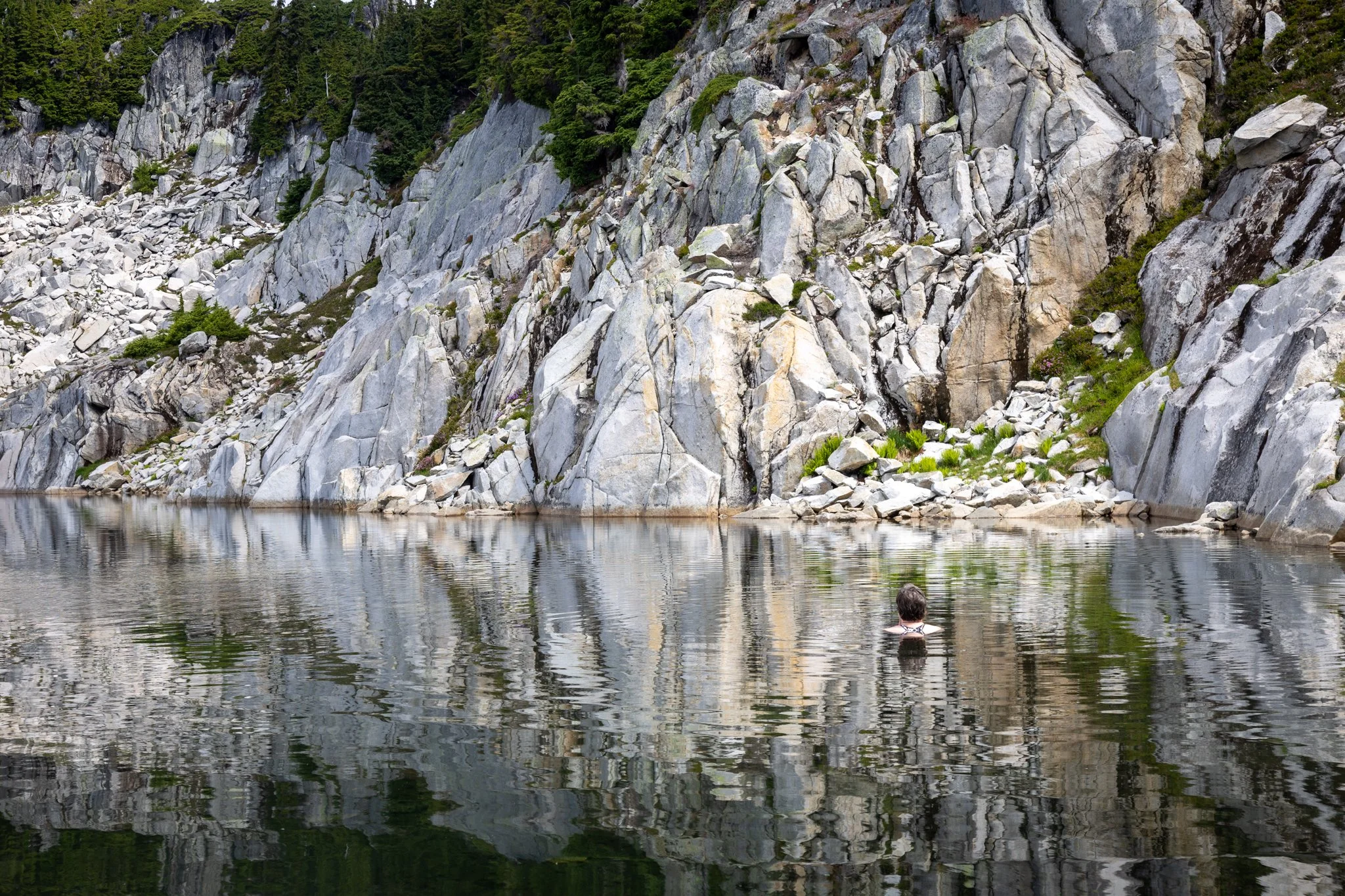
We diverted to the north Tank Lake, where Beck cold-plunged and Baker swam a bit. No one else was around, either. We then went back to camp and relaxed and watched all the other groups make their way to camp. Many spent much of the day wading and swimming in the lake, and more tents popped up close-by. A rather chatty group of women settled about 50 ft to our east; when they first arrived, they sort of questioned how spread out our campsite was, jealous of all our space, while their three tents were crammed on a much smaller ledge. First come, first served, indeed.


Clouds moved up the valley from the west as sunset approached, and spoiled any chance at another nice sunset. We figured by morning we’d be socked in….


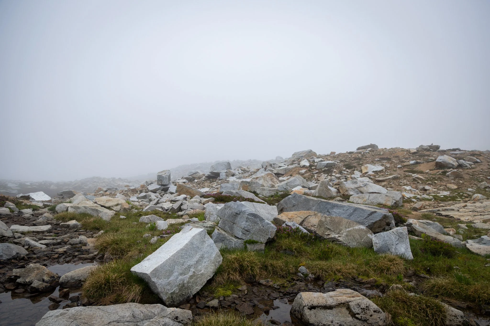
…And we were. Visibility was a hundred yards, maybe, which was fine because we had a full day of hiking ahead of us and I liked the cooler temperature and lack of direct sun. We set ourselves a goal to leave by 7AM and we left a few minutes after 7. We agreed to take a gentler, non-bootpath route down the valley, so we hugged the east side of the creek and all the cairned route options mostly helped. It’s not a difficult route, but if you’re not paying attention, you can end up on a cliffed-out bench you’d have to go-around.


Down, down we went, crossing the final snowfield and then into the meadowy area that approached the jeweled lakes. A quick stop at the one toilet and a reload of water at the Jade Lake inlet, and we began the 9 mile hike back to the trailhead. The rooty, rocky trail was as annoying going down as up, but without all the cardio. Still, though, it was an impressive descent, and over and over we thought how in the hell we ever climbed up all that two days earlier, in the warmer and sunnier weather.


Almost two hours later, we were back at the big log and creek crossing, where we took a long, relaxing break. Paul and Beck soaked their feet in the very cold river, and I laid down on the ZLite. We ate lunch and refilled out water one more time and hiked the final five or so miles back to the trailhead. Hours ago I stowed my camera inside my pack, as my shoulders were getting tired of all that extra weight on the straps. I got a new water bottle holder (long story) that mounts on the front of my shoulder strap, more or less balancing out the camera clip that I use on the other shoulder. In theory, it’s great, but in practice, it’s a lot of weight bouncing around on your shoulder straps, especially if you’re descending. So I moved my water bottle to my pack pocket and stowed my camera in the pack for the unremarkable trail that remained.


We anxiously counted down the last mile and a half, and we finally made it back back to the trailhead about 11 miles and a little over 5 hours since we left our foggy campsite. We said our goodbyes as Paul was heading back to his family in Wenatchee and Beck and I had a 3hr drive back to Deming. Thankfully our US-2 route only had about a 20 minute backup heading west.