Hannegan Peak, May 9th, 2026
We had an epic early season trip up Hannegan Peak with many friends in early May, taking advantage of the earlier-than-usual melt-out of the road and trail.
The trip was set up by Mushtaque Silat who's organized this annual pre-Mother's Day outing for years with many of our friends, though this was the first time Beck and I joined. Outrageous costumes are part of the buy-in, and The Seattle Mountaineers blogged about it a few years back.


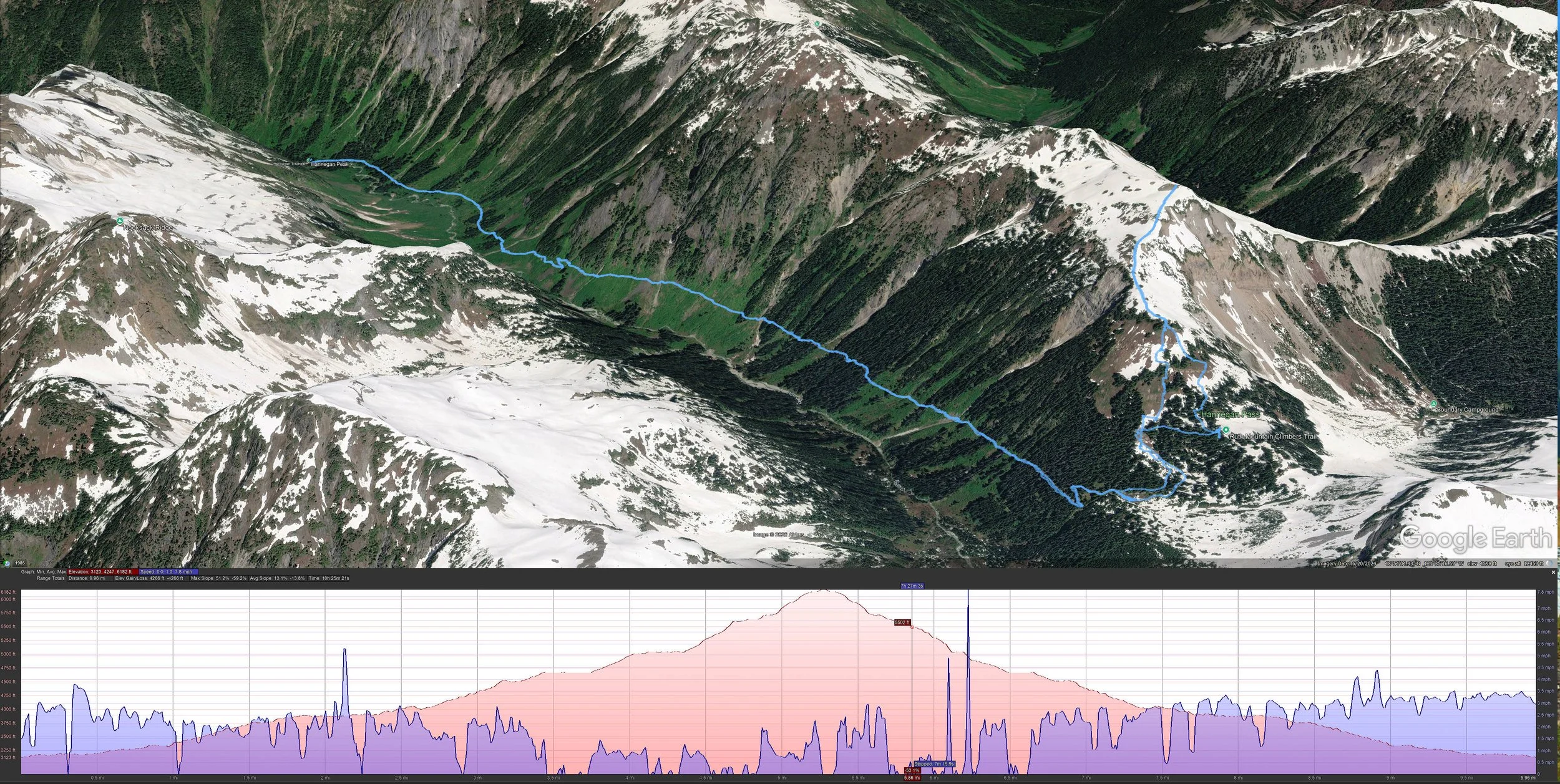
We started at approximately 5:57AM, after the sun had risen; there was a bunch of us and 3 dogs, and we stretched out on the trail as groups do. The first four miles of the hike started kindly before hitting snow before reaching Hannegan Pass. Beck and I hiked the full Copper Ridge Loop back in 2017 which continues well beyond the pass into the northern reaches of North Cascades National Park.
I hiked about 2 miles of the trail a couple of weeks earlier and it was mostly snow-free with only a few patches. This time, we didn’t see any snow until about mile 3. We crossed one snow bridge that was a bit spicy given both the bad run-out if you fell and the nasty potential to break through the snow bridge and fall into the creek and worse.


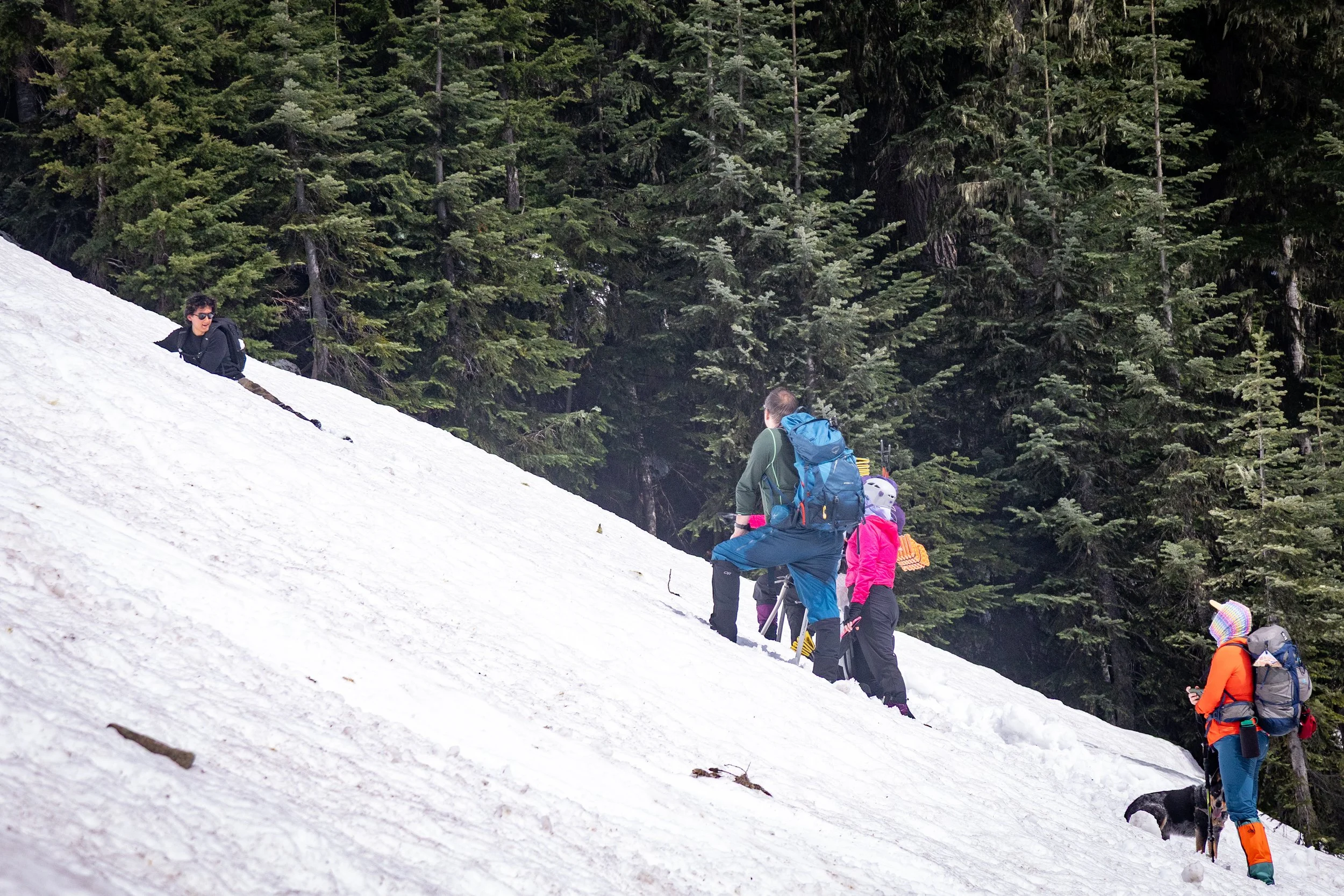
We agreed to all collect at the camping area just before Hannegan Pass, knowing we would need to transition to some gear appropriate for snow travel. I chose to stick with my new trail runners, but had full gaiters to keep the snow out and microspikes for extra grip. Most people switched to boots and spikes, and nearly everyone brought their ice axe, which was a good idea. Beck and I did not, which was a mistake.


Once at Hannegan Pass, we turned left to head up toward Hannegan Peak. With several feet of snow beneath us and lacking any obvious signs of anyone else’s route upward, we just headed up. Two members of the group brought skis, so they followed a route that best suited skinning up as much as possible, which wasn’t very far due to the steepness, so they had to repack their skis and hike up with us.


Nobody made a firm decision about whether we should switchback our way up or just head straight up by kicking in steps. The first few hundred feet we made some long switchbacks, but with the softening snow, no footstep was guaranteed to hold, and a couple of us lost it and slide down a ways in our on personal avalanche of heavy snow. The route wasn’t great, and we had to get ourselves through some pretty challenging brush and none of it was ideal.
It was slow going, too, as we spent a good bit of time testing different routes, backtracking as we doubted our choices. I don’t think any of us were confident in our decisions, and a few of us were quite uncomfortable and doubting the adventure.
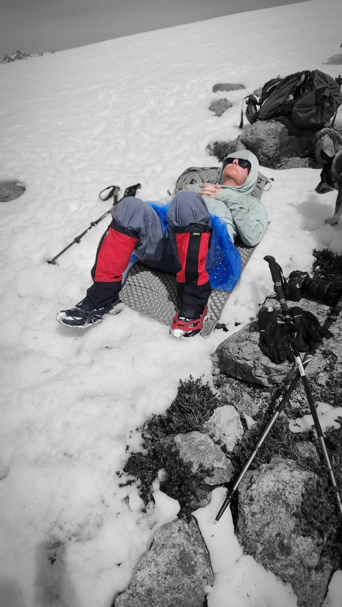
After the slope steepened, approaching 40 and 50 degrees, it was impossible to safely traverse so we headed straight up, kicking in our steps and digging in our poles or axes for grip. Morgan led us up for quite a ways, and I gave her a brief respite and led a ways, but it was exhausting and my feet were cold, especially with trailrunners, and Morgan took over again.


Eventually, we popped out on the false summit at 5,700ft, pretty tired and mentally drained from the sketchiness of some of it. As we arrived, about half of us felt like the false summit was good enough, having covered half the elevation gain to the true summit another 500ft above us, and with great views in all directions. After we collected ourselves, another group passed us by and continued upward, so I think that helped build a bit of confidence that we would be okay to continue. We rallied and turned upward, and any steep sections we kicked steps and were okay, as the upper part was less steep.


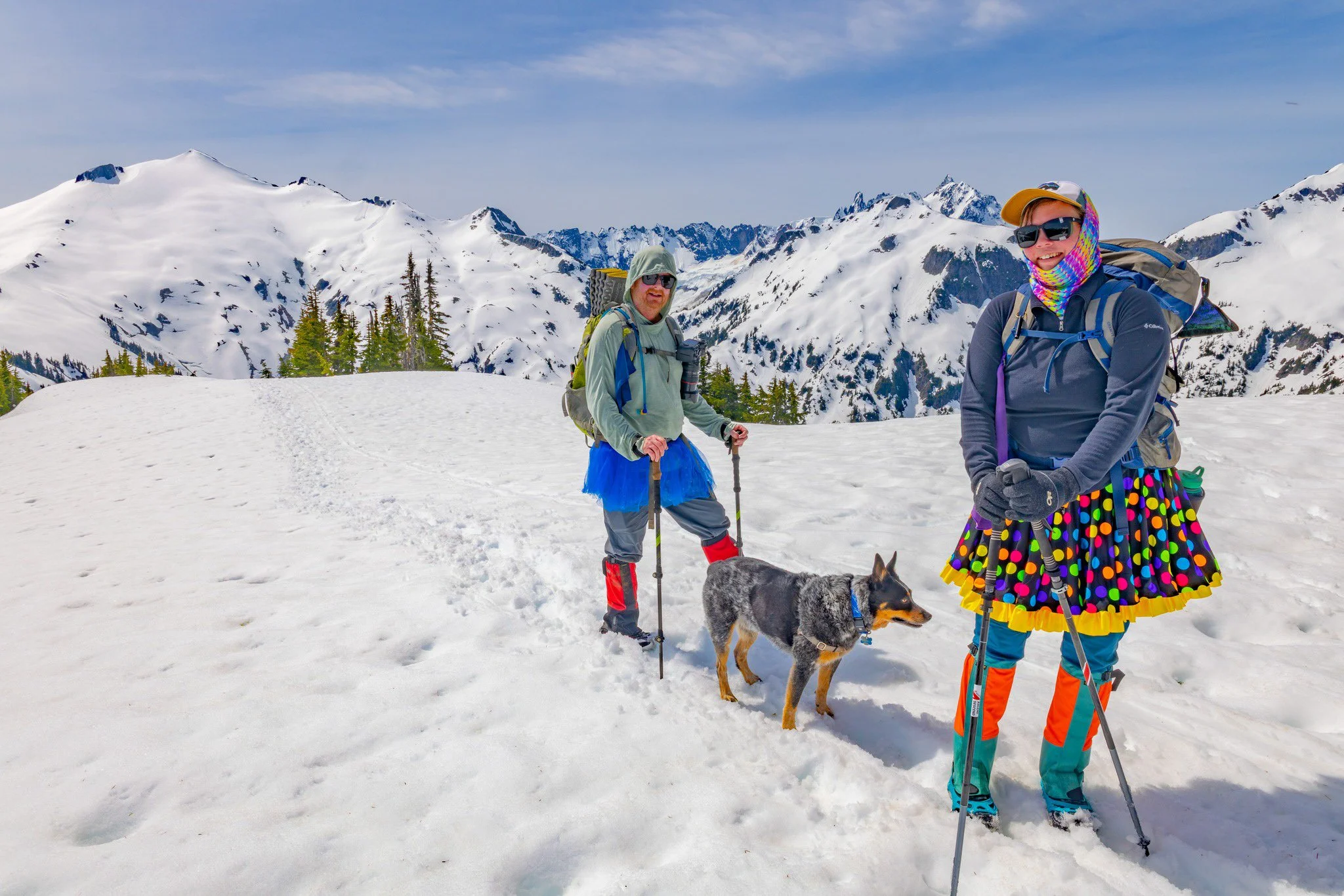
After a couple of more humps on the ridge, we topped out on Hannegan Peak at 6,187ft, where a large rockfield had already melted out and gave us a chance to relax and warm in the sun. At that point we all posed for pictures in our get-ups enjoying a generally silly time while refueling and resting.


A lesser-seen side of Mt. Shuksan with Nooksack Tower on the left
The views from this point were stunning in all directions. Northward we could see Copper Ridge and many peaks into Canada, and to our east we could see the huge snowfield on Mt. Ruth, where we had been monitoring some other parties and skiers heading up.

Mt Ruth; some ski tracks can be seen from the summit where two people are standing, if you look closely.

Mt. Shuksan again
We could see one pair of skiers making turns on their way down Ruth. To our south, Nooksack Tower and Mt. Shuksan were magnificent in their prominence, with their glaciers and rockfall clearly evident. Further southwest was Mt. Baker, partially hidden by the ridge on the far side of the valley we hiked up. We were close to the boundary of North Cascades National Park both to our east and south.


After a long break and enjoying the summit, we turned to head down. In the back of mind I didn’t know exactly what descent would look like over deteriorating conditions. The snow was heavy and soft down to at least a foot, so every step downward was a bit of a slide. While the first section of descent was comfortable, as it got steeper, the steps became completely unpredictable and it was easy to fall and slide uncontrollably. Glissading was an obvious choice, but with glissading you need to assess the entire route and the ability to control your speed, ensuring that you don’t slide out of control into trees or worse.
Initially we had some easy glissades, but as we returned to the trees, the options got a little spicier. The snow was so soft that we could control our speed pretty well with our feet and axes or poles. A couple of points were steeper and the run-out wasn’t safe, so we decided to descend by down-climbing and kicking in steps; fortunately we didn’t have to do this more than a couple hundred feet before we had clear glissading paths.
Tony and Kyle swooshed past us on their skis and got back down to Hannegan Pass in just a few minutes, but it took us well over an hour to catch back up with them as we slowly and deliberately descended.
We helped each other as we made our way down, ensuring people were stopped at their intended spot on the glissade
Once back to the camping area we again collected ourselves and switched out some of our gear for the 4 mile hike back to the trailhead. I was pretty beat by this point given the physicality of moving up and down the peak in the soft snow. Many of us got into our heads and just hiked out on our own, knowing it’d be a slog down the easy trail back to the trailhead.
After the last mile seemed like five miles, we popped back out at the trailhead, where Tony and Kyle had set up an area for us to relax for a minute as everyone filed back in, sharing some beers and some laughs. We then headed down the road to have a dinner at Chair 9 where we recounted the day and thought of future trips.
Track and movement details
In total, we covered over 11 miles, with over 3,200ft of climbing. We were out there from 6AM to about 5PM when everyone was back to the parking lot. After my feet warmed up and dried out, the three middle toes on both of my feet were numb and tingly. I figure they got pretty beat up with the kick-stepping in my trailrunners, and I probably had a bit of Raynaud’s messing with the circulation and nerves. A week later and they aren’t much better; they feel like they’re half there, but they look and function fine; I expect it’ll clear up over time. I regret not switching out to my boots like others did, and I definitely wished I’d brought ice axes to have a more confident tool to manage the snow.
What a great adventure to kick off the season, and especially nice since the hike is only an hour from our doorstep. Spending a day like that with friends was fantastic to share such an epic trip.